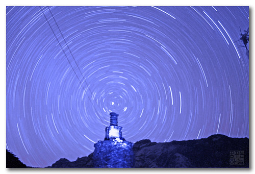
Today, technology seems to have taken over the field of navigation! GPS, global radio contact, navigation aids – so many strides have been made in this field, the world seems to have forgotten the days when sailors would navigate by the stars. Whether they were sailing near their own countries or traversing the whole world in a large ship, their most reliable guides were the sun and the stars. The ancient sailors colonised entire islands by reaching them using just their own sharp minds and the ability to navigate with the help of the celestial navigation.
Pole Star and the Southern Cross
The brightest star in the northern sky, the Pole Star hangs over the North Pole. It is the sailor’s best guide to the northern regions, and due to its unwavering brightness, it is visible for miles around. If the sailors are not able to locate it, they look for the group of stars known as The Plough, and the two outer stars that form the edges of the Plough. These two point directly at the North Star. At the southern sky, the sailors look for the Southern Cross as a marker towards the South Pole. Using the positioning of these familiar stars, the sailors have, for centuries, determined their own position on the seas, and thereby made sure that they were on course.
Mind Maps
The ancient sailors had learnt to recognise the stars and their positions. Their minds retained the star maps and they used the positions to determine where they were going next. The amazing fact was that they steered through in the correct direction, using just the position of the stars, and by determining the height of the stars with the help of the ancient quadrant. Aiming the quadrant at a well-known star, the navigator would determine the latitude of the region, as it can read the degrees on the instrument. Though very simple, it has been very effective for several centuries. In fact, this was how the boats were navigated through the oceans and the seas in the past.
Even though celestial navigation has ceased to be of any importance in today’s age of advancement and technology, it is yet a part of every navigators training to be familiar with celestial maps and be able to find their way around with the help of the stars. This is done as a backup solution, and is also used for calibrating the compass and for correcting errors. A sextant is even today used occasionally to measure the angles. However, the data is now fed into a computer to analyse it and get accurate readings. Celestial charts are still being used by the maritime navigators, in combination with satellite navigation, to determine the course of the ship. By measuring the sun’s altitude regularly with a sextant and by comparing it with a pre-calculated measurement, the navigator can make sure that there are no errors in the course of his ship.
Smaller Sailing Boats
Today, while sailing or steering smaller boats, yachtsman still rely upon navigation with the help of the stars, when they are far away from the coast. Whether they use it as a backup or as their main tool, the stars remain their closest allies. Using chronometers, sextants, compasses and quadrants, they watch the sun and the moon carefully, and combining their skills with modern technology such as GPS, they maintain their course to a remarkable degree of accuracy. Even today, an accurate timepiece is considered to be the best way to measure the time of a sextant sight.
Adrian Hemsley is a guest blogger.


